
Cascading Hazards: Understanding triggering relations between wet tropical cyclones, landslides, and earthquakes
Project Description
The project focuses on exploring a novel physical mechanism for triggered seismicity – surface unloading induced by tropical cyclones, or pore pressure changes at depth – to explain the timing of several recent devastating M≥6 earthquakes and additional M≥5 main-shock events in tropical mountainous areas that were previously hit by very wet tropical cyclones.
Taiwan is an excellent place for evaluating relations between earthquakes, landslides, and cyclones, because: 1. It is tectonically active and has a high rate of seismicity; 2. It is subject to frequent tropical cyclones (3-4 per year), some of which result in huge amounts of precipitation (> 1000 mm); 3. There is an excellent record of these phenomena.
Preliminary studies indicate:
1. We identify 5 cases of wet- typhoons followed by main-shocks within 1 - 4 year period. The occurrence of two M>6 earthquakes within a year since the wettest typhoon Morakot in 2009 poured record rain in central Taiwan. Two other M>6 main-shocks occurred within 2-3.2 years after the very wet typhoon Herb (1996) (Figure 1);
2. GPS detected surface movements were affected by rapid erosion (landslides) induced by the 2009 Typhoon Marokot (Figure 2);
3. A significant increase of the Coulomb failure stress of 100-200 Pa/yr at the hypocenters of both the 1998 M=6.2 Rueyli and 1999 M=7.3 Chi-Chi earthquakes, which followed typhoon Herb (Figure 3).
Significance:
1. The research is interdisciplinary in nature. It synthesizes observations and theories from the following fields: seismology, geodesy, rock mechanics, geomorphology, atmospheric sciences, and computational engineering.
2. The research methods include remote sensing, systematic seismic event detection/data mining, and numerical modeling. The remote sensing analysis uses both optical and radar (SAR) imagery to detect surface changes induced by the wet tropical cyclones. The modeling section includes two types of models, one for calculating stress changes on fault surfaces due to surface unloading and the second due to pore pressure diffusion.
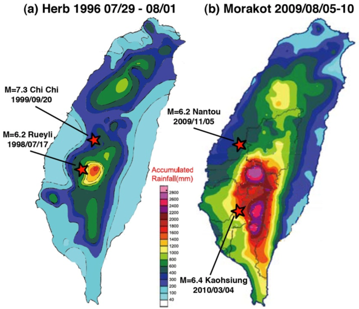
Figure 1: Spatial relations between accumulated rainfall of two very wet typhoons and M>6 main-shocks that occurred shortly after the typhoon.
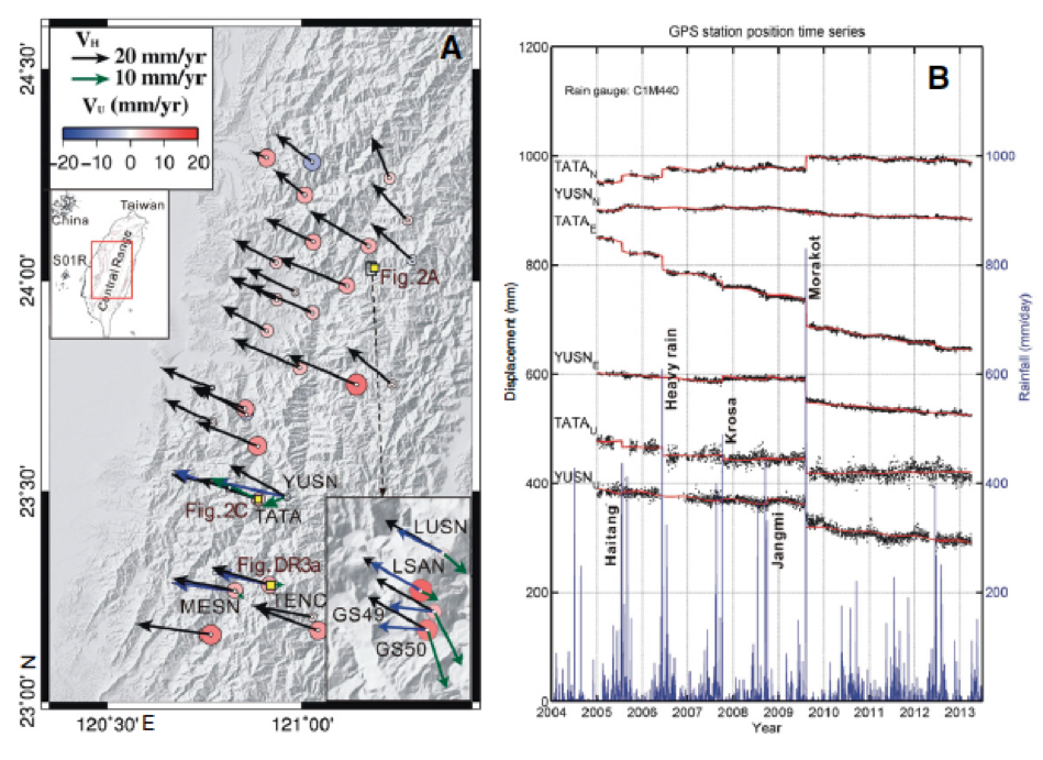
Figure 2: (Hsu et al. 2014) (A) GPS velocities at sites in the Central Range of Taiwan, showing long term motion (black arrows) and short-term offset induce by the Morakot Typhoon. (B) Time series of some of the sites showing the offset.
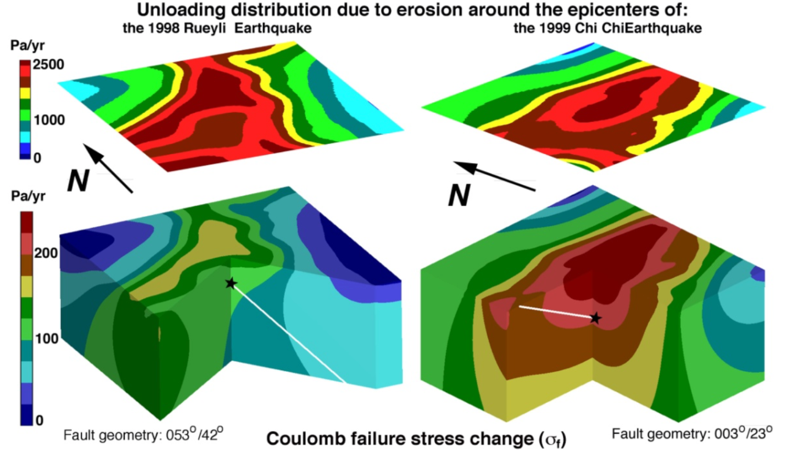
Figure 3: Modeled stress changes due to erosional unloading in the upper 20 km of the crust (lateral scale: 60 km x 60 km).