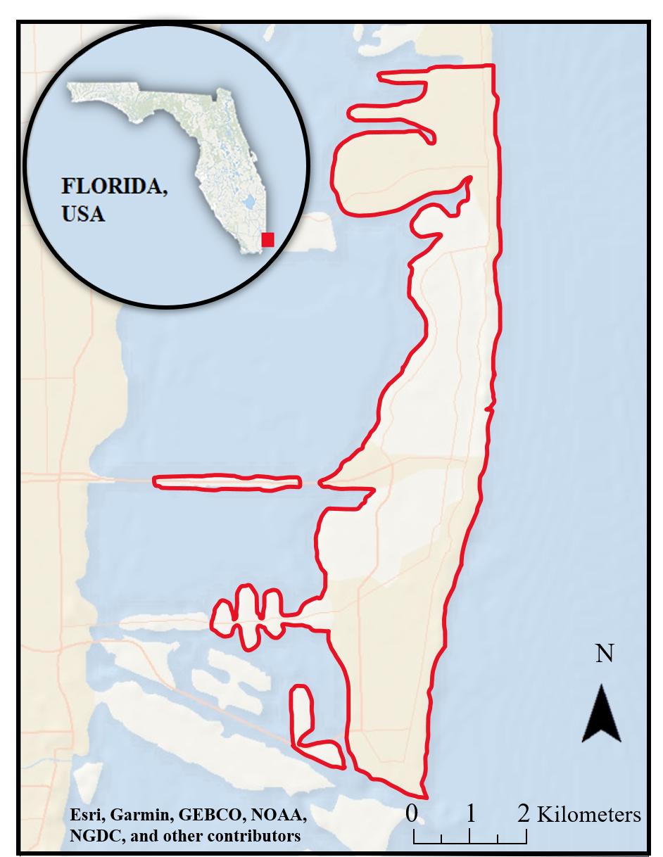
Land Subsidence in Miami Beach Based on Precise Leveling Measurements
ABOUT
Land subsidence, or the vertical displacement of land surface, is a geological phenomenon that can lead to hazardous consequences in urban and suburban environments. It is caused by several processes, including groundwater extractions, sediment compaction, and tectonic and anthropogenic activities (Wong et al., 2014). Subsidence has impacted many cities around the globe in both coastal and inland environments, including Bangkok (Phien-wej and Nutalaya, 2005), Jakarta (Chaussard et al., 2012), Venice (Bock et al., 2012), and Norfolk (Bekaert et al., 2017), Mexico City (Osmanoglu et al., 2011), New Orleans (Dixon et al., 2006), and Houston (Holdahl et al., 1991). Subsidence is a problem that prevails in coastal areas and increases the risks associated with inundation, flooding, and seawater intrusion. Comprehending how subsidence has changed over time contributes to better understanding of how this process will continue in the future and possibly preempt destruction and tragedies (Sarychikhina et al., 2011).
Low-lying coastal environments are the homes of millions of people, who are vulnerable to sea-level rise and its consequences (Cazenave and Le Cozannet, 2014). Land subsidence occurring in coastal areas can increase coastal communities’ vulnerability to flooding hazards, as subsidence increases the rate of relative sea-level rise (RSLR) (Stanley et al., 2017). The increase of RSLR can lead to coastal erosion, flooding, saltwater intrusion, and contamination of freshwater reserves, as observed in Venice (Bock et al., 2012), Miami (Fiasche and Wdowinski, 2020), Jakarta (Park et al., 2016), and Tianjin (Liu et al., 2014). The high subsidence rate in Jakarta (up to 250 mm/yr) increases the possibility of the collapse of sea walls, dikes, and other coastal structures, leading to disastrous situations (Park et al., 2016).
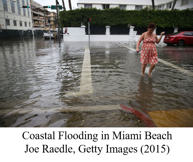
Miami Beach is a low-lying coastal community that has been affected by increasing rates of RSLR (Wdowinski et al., 2016). After 2006, flooding frequency in Miami Beach increased significantly, resulting in an increasing number of high-tide flooding events induced by sea-level rise (Wdowinski et al., 2016). Although most RSLR is attributed to global and regional scale processes, including thermal expansion of seawater, polar icecap melt, and ocean dynamic processes, land subsidence also contributes locally to the increased coastal flooding hazard in Miami Beach. An Interferometric Synthetic Aperture Radar (InSAR) time-series study of SAR acquired during 1993-1999 detected localized subsidence at a rate of 1-3 mm/yr in several locations in Miami Beach (Fiasche and Wdowinski, 2020). Most of the subsidence was detected in the western part of the city in areas built on reclaimed wetlands and are subjected to recurring high tide floodings (Fiasche and Wdowinski, 2020). This study continues investigating land subsidence in Miami Beach by analyzing elevation measurements from an observation period ranging from 1926- 2021. The study is based on precise leveling observations measured by the Miami Beach Public Works Department’s city surveyors. The analysis is based on the differential elevations of the region found across the decades. Our results suggest that localized subsidence can be observed in certain locations of Miami Beach over this time period.
|